|
03 - FIRES PAGE |
| 03 - FIRES PAGE |
| 03 - FIRES PAGE |
|
|
| |
 |
| |
1780 - Upper Cape Forest Fire - 25,000 acres "The Dark
Day"
1900 - Sept 12-15 - Carver-Plymouth "Great Fire"
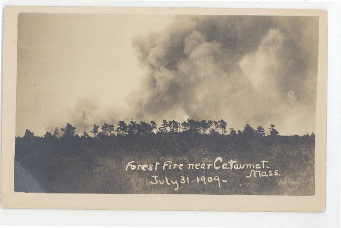
1907 - Upper Cape Fire - Seen from Onset
1923 - May 30 - Pocasset Forest Fire - 7 days - 25,000 acres
1937 - Spring - Bourne-Plymouth Forest Fire - 300 acres -
Herring Pond
1937 - April 27 - Forest Fire Sandwich - 3 Firemen Killed /
Route 130 Memorial
1937 - May 4 - Forest Fire Plymouth - Pine Hills area - 2
Firemen Killed, others burned
1937 - May 4 - Other Plymouth Fires - Island Pond & Summer
St - 700 men fought fires
1937 - May 5 - Hyannis - Forest Fire Ridgewood Ave 2000
acres (Burned up 1937 Breaker)
1957 - May 8 - Carver-Plymouth-Myles Standish - 15,000 acres
1957 - May 8 - Mashpee Plane Crash Forest Fire Hay Road
1964 - May 23 - South Carver - Large Forest Fire
1964 - May 25 - South Carver-Wareham - 5,500 acres
1965 - May 1 - Otis-Sandwich Forest Fire - Jumped Route 6
1971 - May 15 - Plymouth - Myles Standish - 165 acres - 2
fore trucks burned
1986 - March - Otis Forest Fire - Large fire
1986 - April 19 - Otis Forest Fire - Wood Road
1988 - April 22 - Otis Forest Fire - PAVE PAWS 2000 acres
1991 - Plymouth 1200 acres
1995 - May 8 - Plymouth Bourne Road area - 95 acres, homes
threatened
2005 - April 18 - Plymouth Forest Fire Clark Estates
30 acres
2005 - April 20 - Barnstable Mary Dunn Road fire
2007 - April 1 - Nantucket - Large brush fire - Mutual aid
from Cape |
| |
 |
The story of the Cape Cod Brush Breakers begins with an
understanding of the land and its unique forest fire history.
Cape Cod, also known as Barnstable County, is a
bent arm shaped peninsula protruding approximately 70 miles into the
ocean off the southeastern coast of Massachusetts. The land was
created thousands of years ago by the retreat of glacial ice, which
deposited clay, rocks, boulders, and a mostly sandy soil. Huge
chunks of ice that melted formed many of the ponds, lakes, and
rivers found across the area. The coastline is pocketed with many
salt water harbors and bays, and numerous marshlands and wetland
bogs. Inland areas, some with considerable hills, were covered by
vast acres of evergreen pitch pine tree forests.
Just "off Cape" on the mainland side are similar
lands within what is known as Plymouth and Bristol counties. To the
south of the Cape are the islands of Martha's Vineyard and Nantucket
that also share similar natural conditions as the Cape.
Strong, warm, southwesterly winds in the spring
and into the fall tended to dry the forests making them as explosive
as tinder when a fire started. The wind driven forest fires would
frequently burn thousands of acres of forest unchecked year after
year.
Native "Indians" who lived in the area would
cultivate their land and protect their settlements by "firing the
woods" seasonally to reduce the undergrowth and thereby effectively
manage to keep the larger fires from their lands.
After the arrival of the Pilgrims in 1620 and
with the eventual inhabitation of the lands by more and more people,
areas of forests were cut down to create farm lands and to build
homes. Harvested wood heated homes and even enabled industry to
flourish in the area.
Inhabitants throughout history frequently faced
many wild fires that threatened their lands, homes, and businesses.
Fires that grew to thousands of acres would burn for days, creating
billowing clouds of heavy, dark, choking smoke that filled the sky.
Wind driven fires were nearly impossible to stop and frequently
burned until weather changed or the fire reached a natural break
such as water.
In the late 1800s and early 1900s, fire towers
were erected on high grounds so that spotters could observe and
report incipient fires. During the 1920s fire patrol trucks worked
in conjunction with fire towers to spot and attempt to quickly
extinguish wildland fires even before some fire departments were
organized.
As motorize vehicles became more powerful and
available in the 1930s, 1940s, and beyond, a variety of fire
apparatus designed specifically to address the dangerous forest
fires were built.
Forestry studies in the early 1920s found that
the explosive nature of forest fires in southeastern Massachusetts
rivaled conditions in California and other areas where fires rapidly
outrun efforts to contain them.
Many major fires over the years have claimed
thousands of acres of wildland, numerous structures, and have
claimed a number of lives.
Brush Breakers are not utilized in other parts of
the country the way they are here. Topography of the land and other
factors make them useful here and over the decades they have been
used to contain and control many fires which otherwise would have
grown much larger and caused much more of a threat to lives and
property.
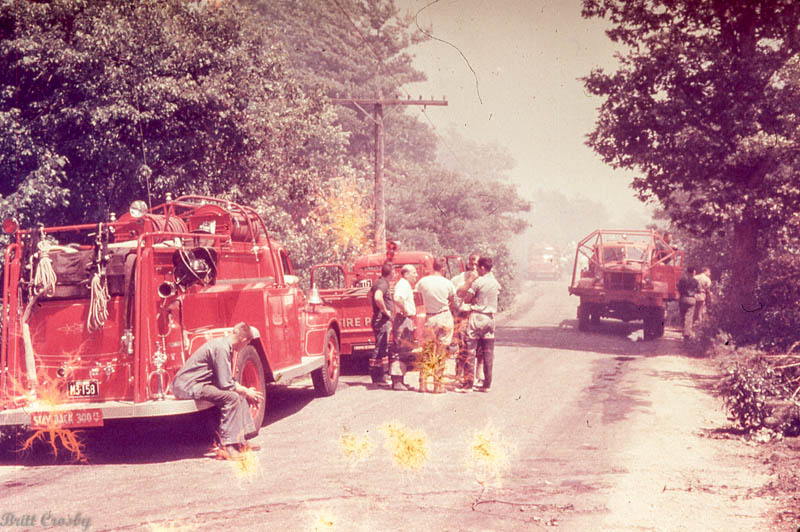
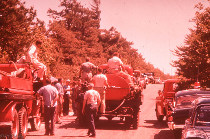
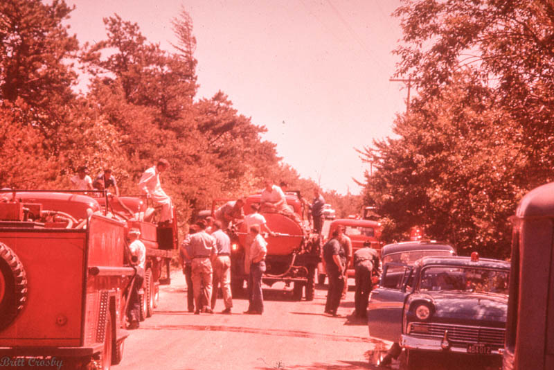
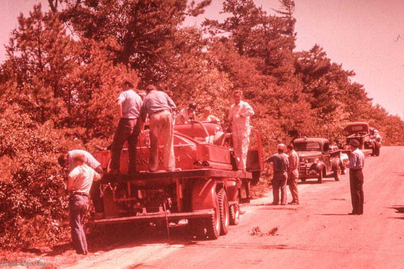
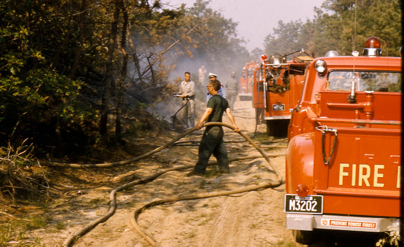
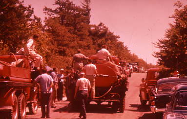
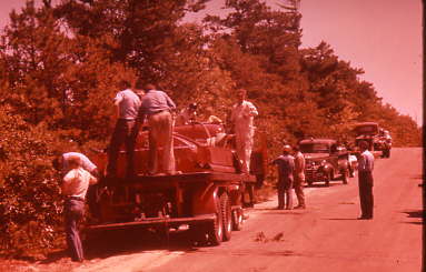
During the larger forest fires, brush breakers
working in groups work to surround and contain the fires so they can
be extinguished using water carried by the brush breakers. Tankers,
or tenders as they may be called, position on dirt roads or other
safe spots to resupply the brush breakers as they make trip after
trip back into the fire until it is controlled.
Over the years, fire tower spotters would observe
smoke as fires began. Two or more towers would utilize compass lines
and maps to cross up a general area of where the fire is located
(way before GPS was even imagined). This information was then
relayed via phone or radio to crews that would respond to the fire.
A system of mutual aid was developed to manage the large fires that
could quickly exceed the ability of one or two trucks to handle.
Radio communications and basic incident command systems were
utilized, again long before the formalized incident command systems
and communications systems we consider standard today. |
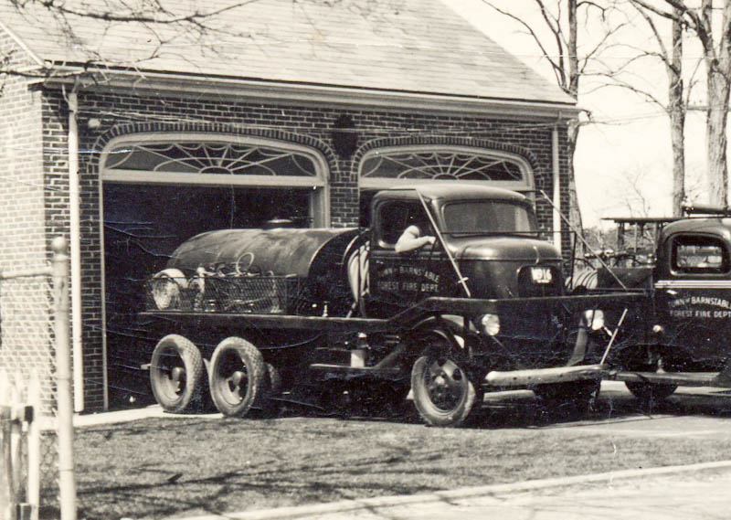
| |
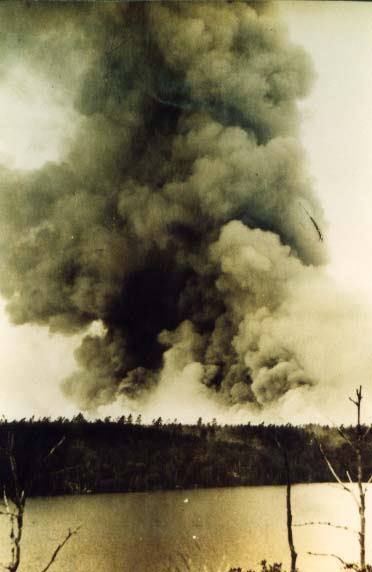
|
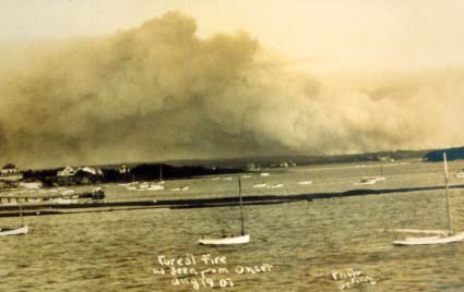
August 1907 photo from Onset bay of a Cape Cod
forest fire.
|
|
In 1780, an early morning lightning storm started a fire in
the woods. Clouds of dark smoke filled the sky to the west of Sandwich in what
was called "The Dark Day." It had been for generations, the practice
to "fire the woods" each year as the Indians had done, usually in April, to burn
off the grass and
seedlings. This practice kept wide stretches of the forest clear of
underbrush
but did not damage the large standing trees.
In 1887, a huge forest fire burned over 25,000 acres from the Pocasset
section of Bourne to Sandwich. This fire destroyed approximately 600
cord of stacked wood at the Sandwich Glass Company as well as several
stands of oak and pine ready for cutting. The Glass company was forced
to then purchase and burn coal in its furnaces at a substantial financial
cost. This, along with a labor union strike, ultimately contributed to the
demise of the Sandwich Glass Company, one of the Cape's largest industrial businesses between 1825 and 1894.
On May 30,1923 a fire began in the woods in Pocasset village. By the end of the
day, it
was thought that the fire was out. By morning however, it picked up again,
burning through
the day. Once again, it was believed that it was under control by
nightfall, only to flare up again
and again for 7 days. An area of approximately 25,000 acres, between Pocasset
village,
Sagamore, Sandwich, East Sandwich, and South Sandwich was left blackened.
The State Commissioner of Conservation stated that "something was radically
wrong" adding that
the fire could have been contained to about 1,000 acres if it had been properly
handled since
it was not even a "fire day." Following this fire, the state purchased
hundreds of acres of
burned over forest in Bourne and Sandwich and created the Shawme State Forest in
1923.
The name was changed in 1938 to the Shawme-Crowell State Forest, honoring
Lincoln
Crowell for his long dedication to the Cape's forests. Crowell was killed
in 1938 when the
patrol truck he was in was struck by a train in Brewster.
"A concerted national fire prevention program (dealing with wildland fires) did
not follow,
until two experiments in 1928.... The Cape Cod Forest Fire Prevention experiment
and the
Southern Forests Education campaign... The Cape Cod program involved 110,000
acres
of scrub oak and pitch pine. The experiment was intended to compare the
costs of
prevention and pre-suppression with those of suppression...." This
statement in "Fire
in America" by Stephen J. Pyne c.1982, demonstrates how serious the forest fire
situation on the Cape was at that time. The Smokey the Bear program grew
out of these
early fire prevention efforts.
Forest fires can be extremely dangerous, especially when fought by hand.
One of the worst
fires ever on Cape Cod struck on April 27, 1938. A number of fires were
burning on the
Cape and in Plymouth County, when another fire began in Sandwich Bourne
Deputy
Chief Gibbs took a crew of young men, volunteers, with him in to fight the fire
west of
what is now Route 130 in Sandwich. 40 mile per hour winds fanned the
flames and the
men were soon trapped by the fire. All received serious burns. Three
men, Thomas
Adams, age 43; Gordon King, age 34, and Ervin Draber, age 28 died that day
fighting
this forest fire. A memorial stands today near the site where they died.
|
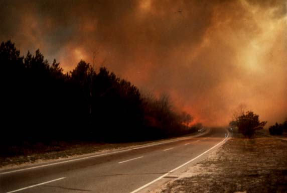
|
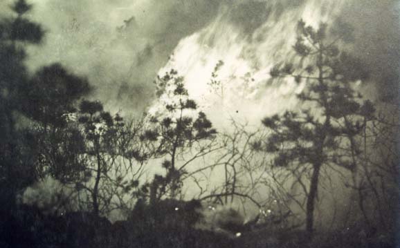
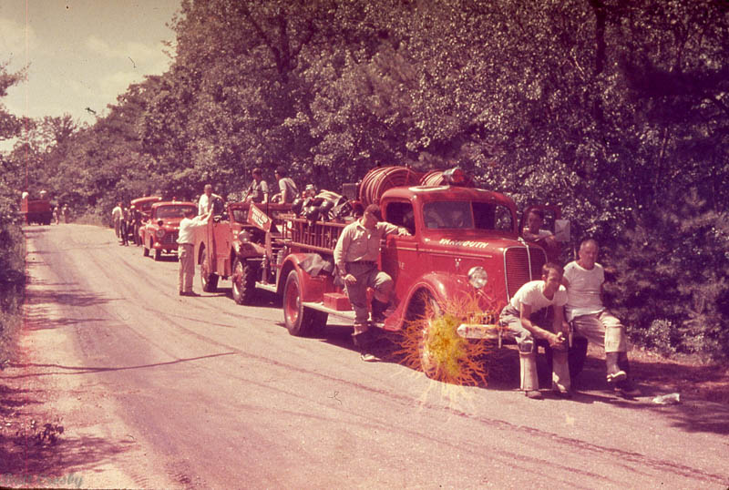
The brush and
forest fire problem on Cape Cod and in the southeastern part of
Massachusetts was severe, particularly in the spring. Thousands
of acres of forest
were burned yearly. The 1920's and 1930's saw many major fires
which led to the need for
a better way of fighting them. As trucks became available and
reliable, the
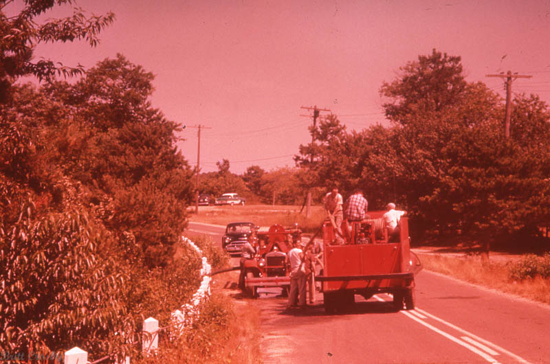
concept of the brush breaker was born.
 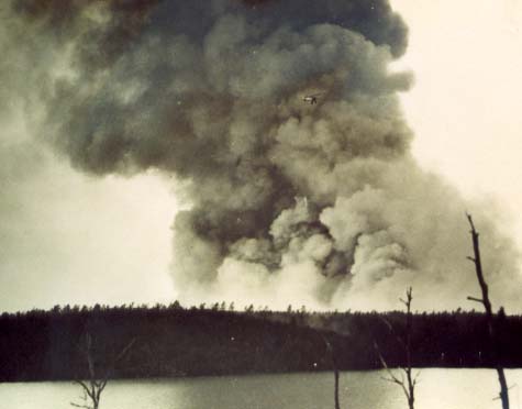
A bi-plane can
be seen against the plume of smoke at this Cape forest fire.
The plane may have been observing conditions from above.
The 1920's
brought attention to the forest fire problem at the state level.
Research into ways to prevent and combat fires, included manned
fire patrol trucks,
fire roads, and fire prevention measures.
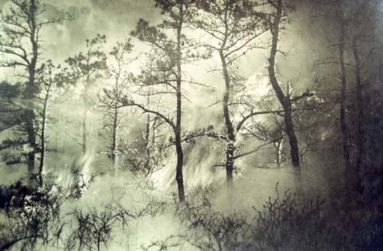
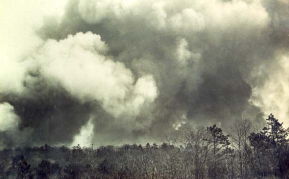
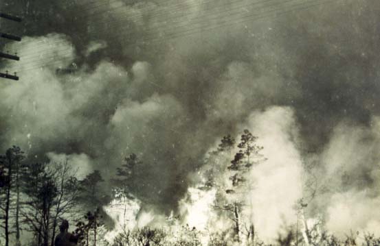
Pine forests in
the spring are explosive fuel.
As fires
increase in size, the length of the side (flank) fire increases.
A sudden change in wind
speed or direction can turn low burning side fire into a
dangerous crowning headfire
Pine trees can
explode as a headfire rages through the forest, up hills and
across valleys.
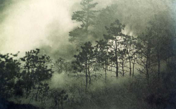
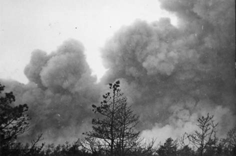
Without a way to
get to these fires while they are still small, fires would grow
to thousands of
acres in a short time. Fires of huge magnitude are not
extinguishable... the just run out of
fuel or go out as weather conditions determine.
Fires threaten power lines, homes, barns, and
local villages. It was not unusual for fires to burns for days,
from one side of the Cape to the other.
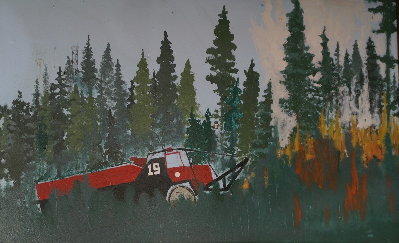
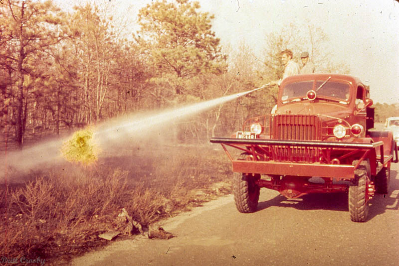
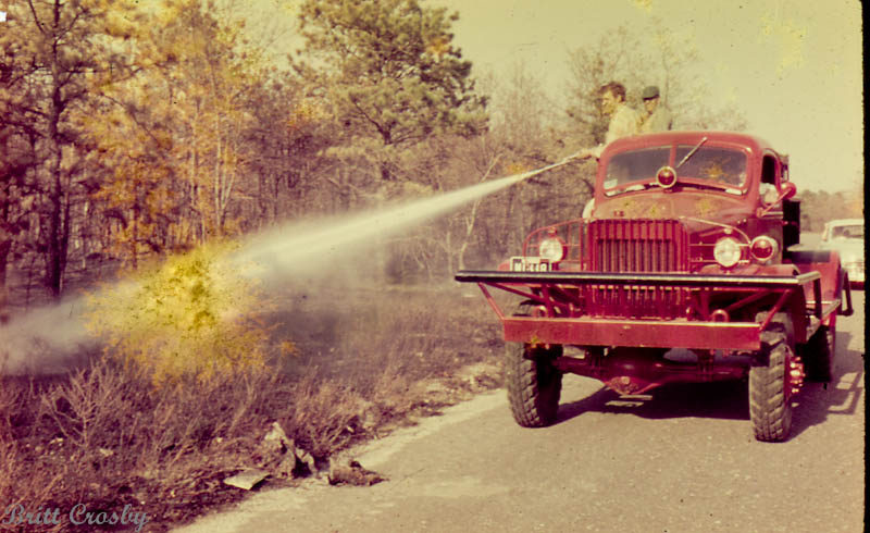
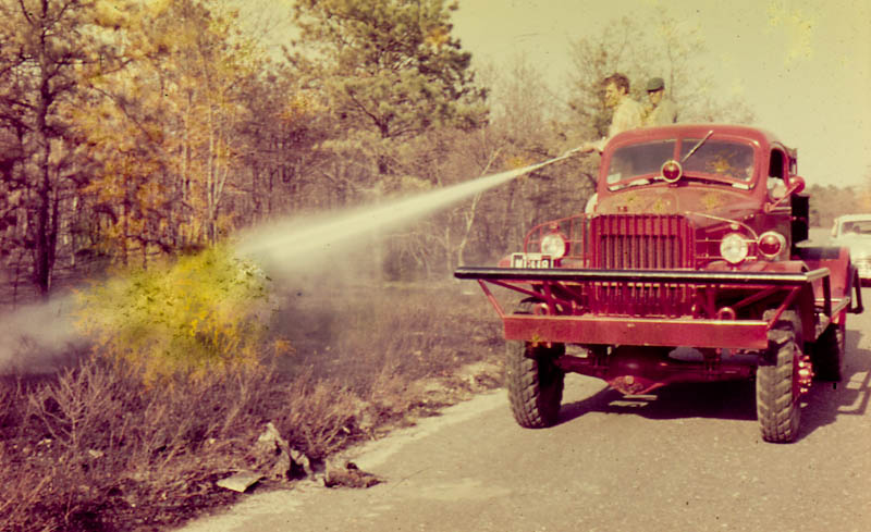
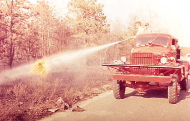
The invention of the brush breaker enabled men
to quickly reach fires, either by fire access roads, or by
driving
cross country through brush and forested land as necessary to
reach and attack fires with water carried on the
brush breaker. Teams of brush breakers working together could
quickly surround and extinguish many fires
before the grew large.
Fast moving fires were very dangerous.
|
| |
|
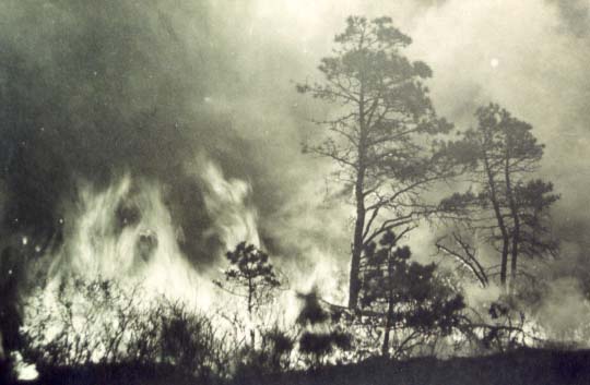
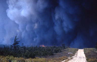
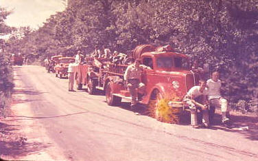
There have been many major forest
fires over the years. Scenes such is this were common across the
Cape and in Plymouth County each year with many of these fires
burning hundreds or thousands of acres. The 1930s saw a number of
particularly bad fires, including the April 1937 fire that came out
of the military reservation into Sandwich which took the lives of 3
firemen. A bi-plane can be seen in this photo, perhaps it was
providing information on the size and direction of the fire. |
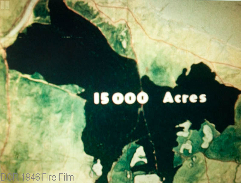 April 19-23, 1946 a large forest fire burned some 15,000 acres over
an 8-1/2 mile path from the Cape Cod Canal near the Bourne Bridge
into East Sandwich. The fire burned over several days and brought
help from fire departments all over Massachusetts. A recently found
State Forest Fire movie documents the fire, and how brush breakers
and fire apparatus battled the blaze.
April 19-23, 1946 a large forest fire burned some 15,000 acres over
an 8-1/2 mile path from the Cape Cod Canal near the Bourne Bridge
into East Sandwich. The fire burned over several days and brought
help from fire departments all over Massachusetts. A recently found
State Forest Fire movie documents the fire, and how brush breakers
and fire apparatus battled the blaze.
|
 CARVER FIRE - 1964
The fire tower spotted a fire starting up in the Farm-to-Market
Road area of South Carver on Monday May 25, 1964 at about 1"00 PM
near where a large fire had been fought two days earlier. Just 3
minutes later, another fire was spotted in the Suther's Marsh Road area off Federal Furnace
Road. Eight brush breakers from Carver and Plymouth responded to
the Suther's Marsh Road fire. Apparatus from Myles Standish and
Wareham responded to the South Carver fire. The Suther's Marsh
fire was controlled in about 2 hours, but the South Carver fire
continued to gain much headway and grew much larger. It moved
east toward Charge Pond Road and Camp Cachalot at Five Mile Pond
and Little Long Pond. The fire then jumped the Agawam River and
burned on to White Island Pond. The Plymouth Fire Chief Arthur
Lamb chose to take a stand at White Island Pond to block the
north end of the fire and at Shangi-La Shores near Glen Charlie
Road to the south. When all was said and done, over 1,000
firemen from Plymouth and Barnstable Counties battled the fires
in gusty 30 mile per hour winds and tinder dry conditions. The
fire burned 5,500 acres and destroyed approximately 30 cottages. |
 SANDWICH FIRE - 1965
It was 75 degrees on May 1, 1965. Winds were gusting to 35 mph
from the southwest. At 12:54 PM, the Bourne fire tower reported a
brush fire near Forestdale Road and Pocasset Road on the military
reservation. Within minutes the fire was already growing rapidly and
the fire tower reported the fire looks "real bad." Brush breakers
from several towns were called in desperation as fire chiefs
recognized the extremely dangerous combination of heat, wind, and
dry conditions. Twenty minutes later the fire patrol plane advised
that the fire had already burned 40 to 50 acres and was moving
rapidly towards Sandwich. Even with mutual aid coming from across
southeastern Massachusetts, the huge fire burned thousands of acres
on its way to jumping the Mid-Cape highway at 2:20 PM and continuing
to burn down into Sandwich village before being controlled. |
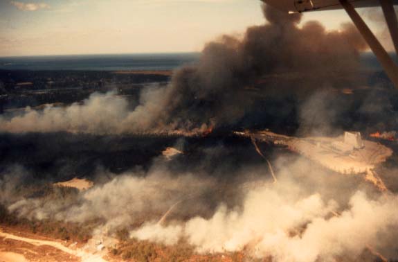 Approximately 2,000 acres burned around the PAVE PAWS radar
installation at the Massachusetts Military Reservation (Otis ANGB) on April 22, 1988. Flames
60'-100' in the air were observed as the fire raged through the
northern end of the base. Mutual aid came from two counties to
fight the fire. The photo was taken from the County Patrol Plane
P-18.
Approximately 2,000 acres burned around the PAVE PAWS radar
installation at the Massachusetts Military Reservation (Otis ANGB) on April 22, 1988. Flames
60'-100' in the air were observed as the fire raged through the
northern end of the base. Mutual aid came from two counties to
fight the fire. The photo was taken from the County Patrol Plane
P-18. |
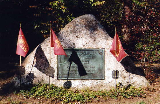
APRIL 27, 1938One of the
worst forest fires in the history of Cape Cod was on April 27, 1938
in Sandwich. A fire that started in the National Guard camp at Camp
Edwards grew quickly, eventually burning an area 12 miles long and 5
miles wide into the Shawme Crowell State Forest. Several firemen would become
trapped by the fire and suffered severe burns. Three of them, Thomas
Adams, Ervin Draper, and Gordon King, died from their injuries
making this one of the worst fires in Cape history.
A simple memorial is maintained by the State Forest
Fire folks in a small park off Route 130 in Sandwich near where the
men perished. |
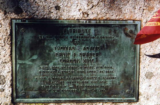
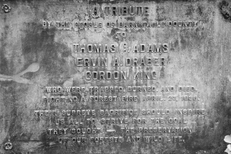
A TRIBUTEBy the People
of Barnstable County
to
THOMAS ADAMS
ERVIN A. DRABER
GORDON KING
Who were trapped, burned, and died
fighting a forest fire April 27, 1938
Their supreme sacrifice should inspire
all of us to strive for the goal
they sought - the preservation
of our forests and wild life.
|
 |
| |
|
PLYMOUTH FIRES
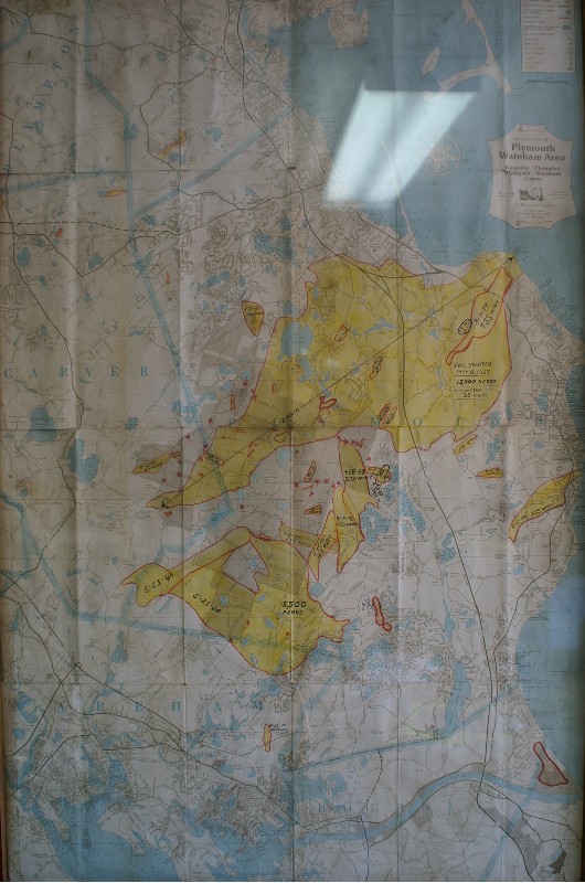
This map is on the wall in the
District 2 headquarters at Myles Standish State Forest.
It shows some of the major fires that have burned in the Plymouth / Carver area.
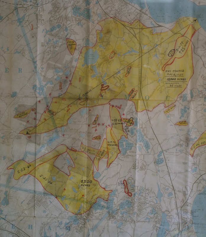
|
Some of the fires
in the Plymouth History:
Some of this information provided
by John Hedge, Plymouth FD Captain (Retired) who had researched area
news reports about some of the great Plymouth fires.
The Great Fire of 1900
September 12, 1900 - September 15, 1900
A fire started near Carver and burned to the shores of
Cape Cod Bay. Strong gusty winds, the remnants of the great
Galveston (Texas) Hurricane fanned the fire as it burned four miles
in 30 minutes at one point. The fire destroyed many structures
as well.
Spring 1937
A fire bug was blamed for a large number of fires in
Plymouth during the spring and summer of 1937. One fire burned about
300 acres from the Bourne town line to Herring pond.
On May 4, 1937 a fire started in the Pine Hills
near Mast Road. A sudden change in the wind caused the fire to
sweep across Sandwich Road. Two firefighters, James H. Devitt,
aged 20 and Herbert R. Benton, aged 38 were trapped on the
road and were killed. These are believed to be the first
firemen killed in Plymouth. There were many more men on that road at
that time who barely escaped, some of whom were badly burned.
While that fire was burning another fire began on
Island Pond Road, and yet another on Summer Street in Plymouth.
With these three large fires burning at the same time, help was
called from departments within a 20 mile radius. Over 700 men
fought the fires.
The following day, another fire began just north
of Ponds Road and burned to State Road. These four fires over
two days were more than usually experienced in five years. Other
fires were set, but controlled with less damage over the next few
days.
May 8, 1957
15,000 Acres burn in a massive forest fire that burned
from Cranberry Road in the Myles Standish forest in Carver to the
water in Manomet. The fire which began about 3:00 PM on Wednesday
had a 3 mile front within an hour. A brisk, strong
southwesterly wind drove the fire about 12 miles.
About 30 minutes before the fire began, a Plymouth
brush breaker had been sent to battle a fire in Mashpee on the Cape.
This breaker was recalled to fight the fire in the home town of
Plymouth. Apparatus responded to this fire from Framingham to
Provincetown according to reports, including apparatus from
Falmouth, Harwich, Truro, Onset and Bourne, as well as other
Plymouth County departments and all the State apparatus in
Southeastern Mass. Soldiers from Otis and prisoners from Plymouth
were put to work as were many local and state police officers.
Plymouth Fire Chief Everett B. Wood ordered the evacuation of more
than 150 people. Approximately 6 cottages were destroyed. Over
3,000 firefighters battled the fire it is estimated.
May 23, 1964 - Saturday
A large fire burned in the South Carver area.
May 25, 1964 - Monday, Approx 1:00 PM
The fire tower observed a fire starting up in the
Farm-to-Market Road area in South Carver near where the fire burned
on the previous Saturday. Just three minutes later, another fire was
spotted in the Suther's Marsh Road area off Federal Furnace Road.
Eight breakers from Plymouth and Carver responded into the Suther's
Marsh Road fire. Other apparatus from Wareham responded into the
Myles Standish fire. The Suther's Marsh fire was controlled in two
hours, but the other fire continued to gain headway and was now much
larger. It moved eastward towards Charge Pond and Camp
Cachalot at Five Mile Pond and Little Long Pond. It jumped the
Agawam River and moved to White Island Pond. Chief Arthur Lamb
chose to take a stand at White Island Pond to block the north end of
the fire and at Shangri-La Shores near Glen Charlie Road to the
south. About 1,000 men battled the fire with winds gusting to 30 mph
and tinder dry conditions. About 20 cottages lost. About 5,500
acres burned.
May 15, 1971
Seven Plymouth firefighters were burned in a fire that
destroyed 165 acres when wind direction changes burned firefighters
on two brush breakers. The two damaged vehicles were a 1955 Dodge
Power Wagon and a 1968 International. The fire was on the east side
of Myles Standish in the Camp Squanto BSA campground. More
than 40 apparatus from Plymouth and Barnstable counties fought the
fire.
1991
About 1,200 acres were burned.
May 8, 1995
A fast moving fire whipped by 25 mph winds forced
hundreds of residents to flee a fire in the Captains Country and
Wind Shores neighborhoods about 1:30 PM quickly destroying 95 acres
and threatening more than a hundred homes in the Bourne Road area.
Mutual aid from 18 departments responded.
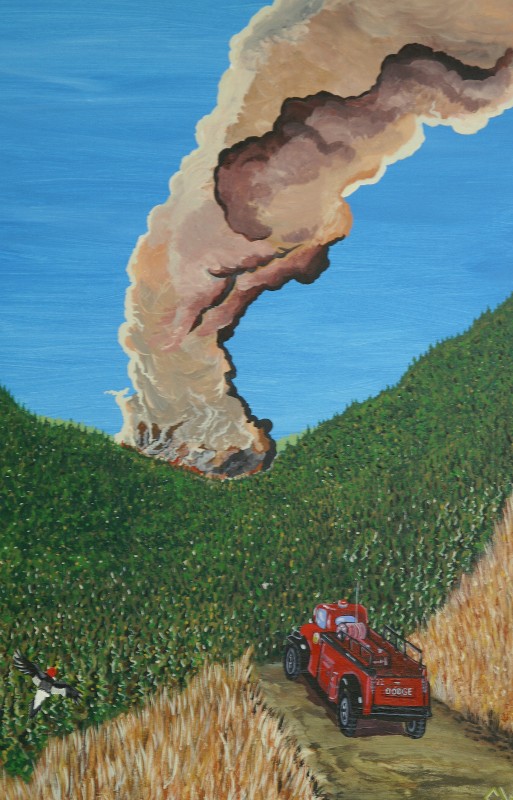
Painting in the Myles Standish
headquarters.
|
| |
| |
|
|
|
|
| |
| |
| |
| |
| |
| |
| |
| |
| |
| |
| |
| |
| |
