|
CapeCodFD.com |
|
[Home]
[Features]
|
|
 CAPE COD BRUSH BREAKERS
|
|
 |
|
HISTORY - IN REVIEW
Brush & Forest Fire
Apparatus History
BARNSTABLE COUNTY
|
|
~
THE STORY ~
~ SPOTTING FIRES - FIRE TOWERS ~
PAGE 11
Page Updated January 26, 2022 |
|

|
|
MAIN INDEX PAGE
Start This Page
|
|

Cape Cod Brush Breaker
Barnstable County Forest Fire Service No.1 - 1957 Ford/Maxim
|
|
|
|
PAGE CONTENTS |
M - Map
01 - The Cape Cod Forest Fire Problem
02 - Historical Cape Cod Forest Fires
03 - One Large Cape Cod Forest Fire - 1946
04 - Cape Cod Forest Fire Jumped Route 6 - May 1965
05 - Plymouth County Forest Fires
06 - Some More Recent Forest Fires
07 - The Fire Danger - Firefighter Memorial
08 - Fire Prevention - Only You!
09 - Public Education - Smokey Bear
10 - Spotting Fires - Fire Towers
11 - Spotting Fires - Fire Patrol Planes
12 - Locating Fires - Fire Patrol Trucks
13 - Early Firefighting - By Hand
14 - Early Fire Apparatus
15 - First Brush Breakers
16 - Barnstable County Brush Breakers
17 - State Forest Fire Trucks
18 - On The Islands - Brush Trucks
19 - Plymouth County - Brush Trucks
20 - Brush Breakers Working
21 - The Hey Day of Brush Breakers
22 - Tankers and Other Support Apparatus
23 - Forest Fire Training
24 - Small, Medium, and Large Brush Trucks
25 - The Newest Brush Trucks
26 - The END TIMES
|
| |
|
M |
|
MAP |
|
<PREV
TOP NEXT> |
|
CAPE COD & THE ISLANDS
BARNSTABLE COUNTY |
BARNSTABLE COUNTY
Cape Cod is located in southeastern Massachusetts. Historically and
officially, Cape Cod is also known as Barnstable County. There are
15 towns within Barnstable County. Within those towns there are many
smaller villages and communities. These towns and villages are
served by a number of municipal, state, and federal fire departments
and agencies. Over the years there were a number of town, county,
and federal fire departments and agencies that no longer serve. Most
of these departments and agencies have battled forest fires over the
years and are recognized within this feature.THE ISLANDS
The area is often referred to as Cape Cod & The Islands. This also
includes the two major Islands of Martha's Vineyard and Nantucket.
Both are counties themselves. Martha's Vineyard is Dukes County and
Nantucket is also a County. Several departments and agencies also
provide firefighting on each of the islands.
PLYMOUTH COUNTY
Located adjacent to the Cape Cod & Islands region is Plymouth
County, also made up of a number of towns, districts, and agencies
serving their communities. All have also been involved in fireghting
forest fires over the years.
BRUSH BREAKERS
This feature focuses on the Cape Cod Brush Breaker fire apparatus,
but the effort to battle forest fires over the years involves much
more that just those apparatus. Some structural fire apparatus was
adapted over the years to battle brush and forest fires. Larger
tankers are frequently used to re-supply and support the operation
of other apparatus at major fires. Spotting, reporting, and locating
fires quickly over the years included the use of fire towers,
airplanes, forest fire patrol trucks, and other means.
FOREST FIRES
The Mutual Aid System, including sharing of large numbers of
apparatus and personnel, was developed and utilized many times
during large brush and forest fires in each of the Counties. Common
radio channels and unit numbering were designated in large part to
improve operations during these large incidents.
This feature addressing each of these topics and more to put into
perspective the importance of Brush Breakers, and all other aspects
of battling Forest Fires in the Cape Cod & Islands area. |
| |
| |
|
01 |
|
<PREV
TOP NEXT> |
1 - THE CAPE
COD FOREST FIRE PROBLEM
|
|
Forest fires raging through pine forest. |
Cape Cod and other areas of Southeastern Massachusetts are known for
the many serious brush and forest fires that struck communities over
the years. |
| |
|
02 |
|
<PREV
TOP NEXT> |
2 - HISTORIC
CAPE COD FOREST FIRES
|
|
Historic forest fires raged across Cape Cod many times.
Aug 1907 Fire |
Going far back in history, large forest fires have impacted
communities and industries. |
| |
|
03 |
|
<PREV
TOP NEXT> |
3 - ONE
LARGE CAPE COD FOREST FIRE - 1946
|
|
The 1946 Forest Fire burned about 15,000 acres |
A 1946 Forest Fire in the upper Cape burned for days. It covered
about 15,000 acres. A documentary film was made showing the progress
and response to the fire including the use of brush breakers of that
time. |
| |
|
04 |
|
<PREV
TOP NEXT> |
4 - CAPE COD
FOREST FIRE JUMPED ROUTE 6 - MAY 1965
|
|
1965 Fire jumped Route 6 in Sandwich |
A rapidly moving forest fire that started in the Otis/Camp Edwards
Military Reservation raged to and jumped over the Mid-Cape Highway
(Route 6) in Sandwich on May 1, 1965. It scorched and blackened many
acres of forest visible for a number of years. |
| |
|
05 |
|
<PREV
TOP NEXT> |
5 - PLYMOUTH
COUNTY FOREST FIRES
|
|
Map showing some of the historic Plymouth County Forest Fires. |
There is a map inside the Myles Standish State Forest District 2
Headquarters showing some of the many significant fires that have
struck Plymouth County over the years. |
| |
|
06 |
|
<PREV
TOP NEXT> |
6 - SOME
MORE RECENT FOREST FIRES
|
|
The PAVE PAWS Forest Fire burned in the 1988. |
A large fire known as the PAVE PAWS Fire occurred on April 22, 1988.
It burned about 1600 acres around the radar site. Photo taken from
Fire Patrol Plane P18. |
| |
|
07 |
|
<PREV
TOP NEXT> |
7 - THE FIRE
DANGER - FIREFIGHTER MEMORIAL
|
|
Firefighter Memorial Route 130 in Sandwich |
A forest fire on April 27, 1938 burned out of the Camp Edwards
National Guard Camp, eventually covering a 5 mile wide by 12 mile
long area toward Sandwich into what would be the Shawme Crowell
State Forest. Three of the firemen who battled the blaze were
trapped, burned, and killed by the fire. The memorial remembers
Thomas Adams, Ervin Draber, and Gordon King who were lost that day. |
| |
|
08 |
|
<PREV
TOP NEXT> |
8 - FIRE
PREVENTION - ONLY YOU!
|
|
The prevention of forest fires became a major effort. |
"Only you can prevent forest fires." |
| |
|
09 |
|
<PREV
TOP NEXT> |
9 - PUBLIC
EDUCATION - SMOKEY BEAR
|
|
Smokey Bear |
Public education and fire prevention go hand in hand. |
| |
|
10 |
|
<PREV
TOP NEXT> |
10 -
SPOTTING FIRES - FIRE TOWERS
|
|
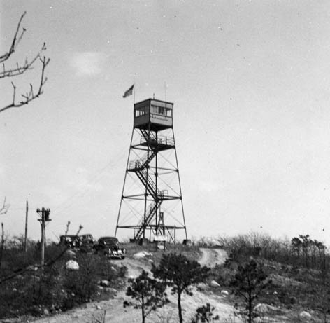
Fire towers, like this one in Barnstable in 1919, were staffed by
spotters who
overlooked the Cape and other areas looking for smoke as fires
started. |
Fire towers became a vital part of combating forest fires. The
earlier the fire could be detected and reported, the sooner it could
be contained. |

As early as the late 1800's, observation posts (fire towers) were constructed so
that
observers could spot smoke early and try to locate fires while still small.
This tower was and still is located in Wellfleet.
The Falmouth Fire Tower was constructed in 1914.
Barnstable Fire Tower on Shootflying Hill
in 1919.
Shootflying Hill in 1920
This fire tower in West Barnstable oversees much
of the mid Cape
area. It is located along Route 6. The trees are all grown up now.
The Barnstable Fire Tower in 1992.
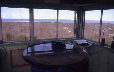
Inside the fire tower is a centrally located map.
Observers simply get a line
on the smoke and by crossing lines from two or more towers, the fire can
be located and communicated to fire fighters.
Wellfleet Fire Tower
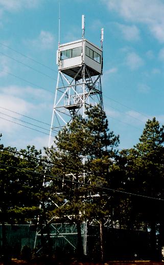
Sandwich Fire Tower, like most of the others, have become more
cell phone and radio towers than fire observation towers in
recent years. This is somewhat poetic since the invention of the
cell phone had greatly improved the ability of the public to call in fires
early from their cars.
Another example of modern technology competing with the need for fire
towers.
Bourne Fire Tower.

Brewster Fire Tower
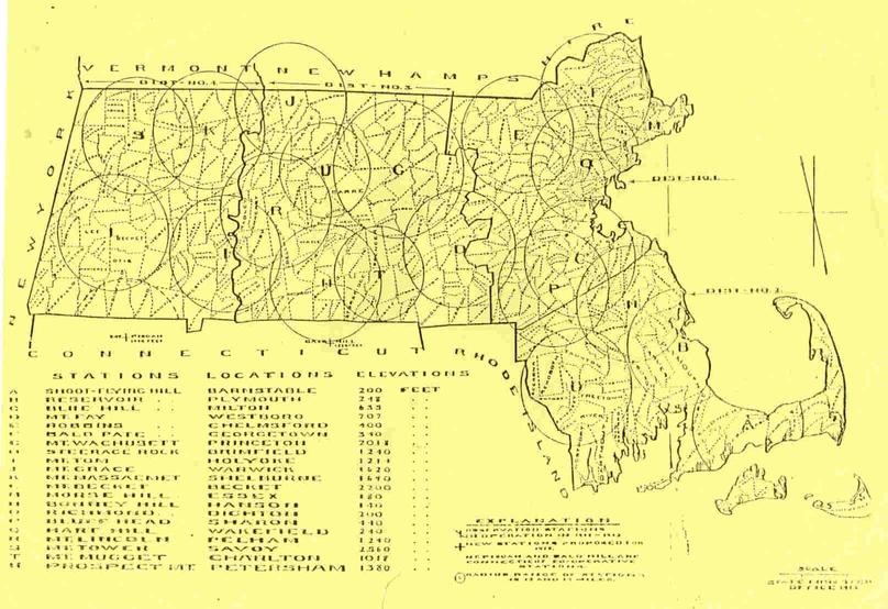
Map display of Massachusetts fire towers in 1913
| SPOTTING FIRES |
| As early as the late 1800s,
elevated observation posts, commonly referred to as Fire Towers were
built upon high grounds. The towers were placed strategically around
the state to be able to observe smoke and report brush and forest
fires to local fire departments.
Staffing of the fire towers was done by
men and women who were very skilled at recognizing the difference
between a chimney or contained fire, and a wild fire that was
starting. Within the small shelter cab at the top of the tower, the
tower operator or spotter, would use binoculars and a map to line up
a smoke based on a compass bearing, and by judging a distance based
on familiar landmarks such as church steeples, water towers, ridges,
or bodies of water. The tower would work with other towers in the
area to try to triangulate the smoke and pinpoint the origin of the
fire. It would then be radioed to patrol trucks or the local fire
department who would respond based on the report from the tower. The
color, volume, and height of the smoke would all be assessed and
reported if the fire started to grow particularly fast or was moving
out in a different direction. Crown fires, flames leaping above
trees, could sometimes be observed indicating a fire that was
rapidly becoming out of control.
Next to actually preventing a fire from
starting, the fire towers were one of the most valuable tools for
spotting fires in their incipient stage when they might be able to
prevent a large fire from gaining size. It is important to remember
that the ability to observe and report fires that were away from
populated areas was very limited. Telephones were wired in only some
homes or businesses. Radios were not even available in the early
days of towers, and later were usually in towers, fire stations,
patrol trucks, and chief cars. Fires often gained great headway
before the word could get out and equipment could be dispatched.
There were, and still are, several fire
towers in the Cape, Islands, and Plymouth area. While the
staffing and use of the fire towers is not what it once was, towers
are still staffed during the fire season to report on fires.
|
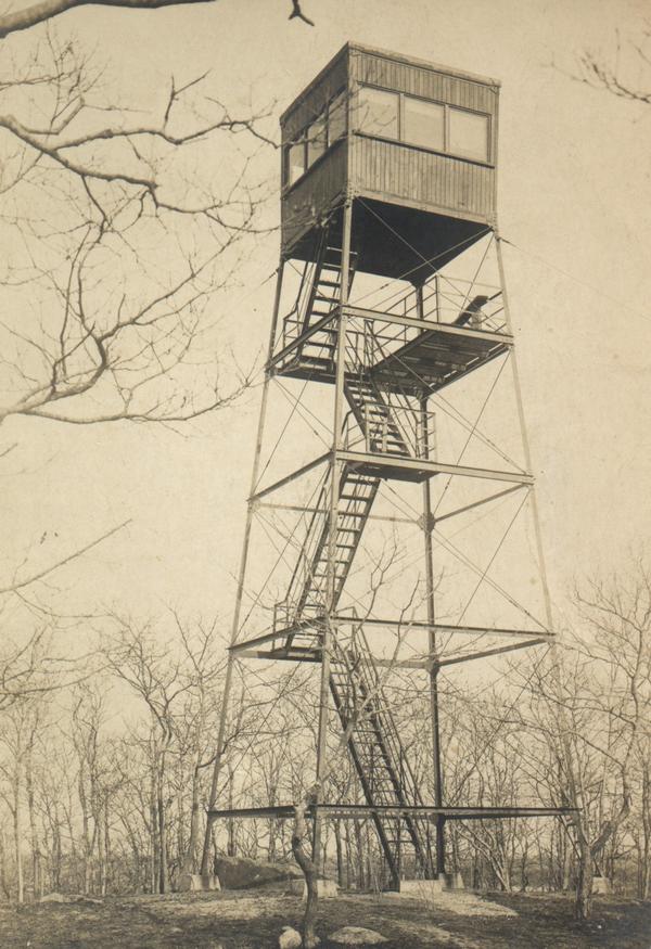
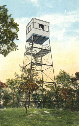
| BARNSTABLE FIRE TOWER |
The first fire tower used by the
state was a wooden tower built by public subscription in 1897 on
Shootflying Hill in West Barnstable. In 1912, a wooden watchman's
cabin was built on top of the tower. In 1914, a sturdier steel tower
was erected with Barnstable and Yarmouth paying a total of $500 to
construct it. At this time, about 1 mile of telephone cable was also
laid enabling telephone service for the first time. This photo of
the Barnstable Fire Tower was taken in 1919.
|
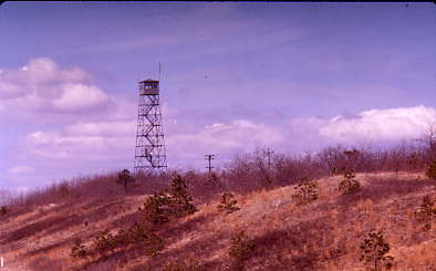
| BARNSTABLE FIRE TOWER |
This picture shows the
Shootflying Hill Barnstable Fire Tower in 1920. The first two
way radio was installed in 1937 allowing the tower to communicate
with the few stations, chief cars, and patrol trucks that had radios
at the time.
|
| BARNSTABLE FIRE TOWER |
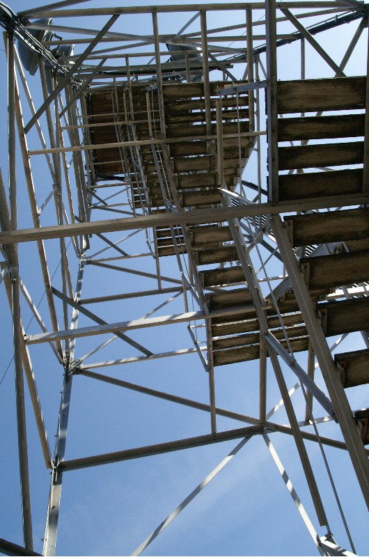
The Barnstable Fire Tower was
relocated to Clay Hill in 1948. The hill elevation around 200' and
the 68' high tower put the observed about 250' above sea level. The
steel tower is accessed off of Oak Street, West Barnstable. The
tower cab was rebuilt around 1968-69. The tower is located along the
Mid-Cape Highway, Route 6 between exit 5 and 6. From the Barnstable
Tower, an observer can see most of the Cape as well as Cape Cod Bay
and Nantucket Sound. This photo was taken c.1960s showing
surrounding trees
|
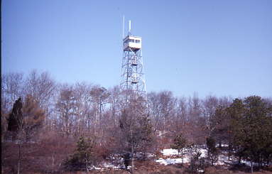
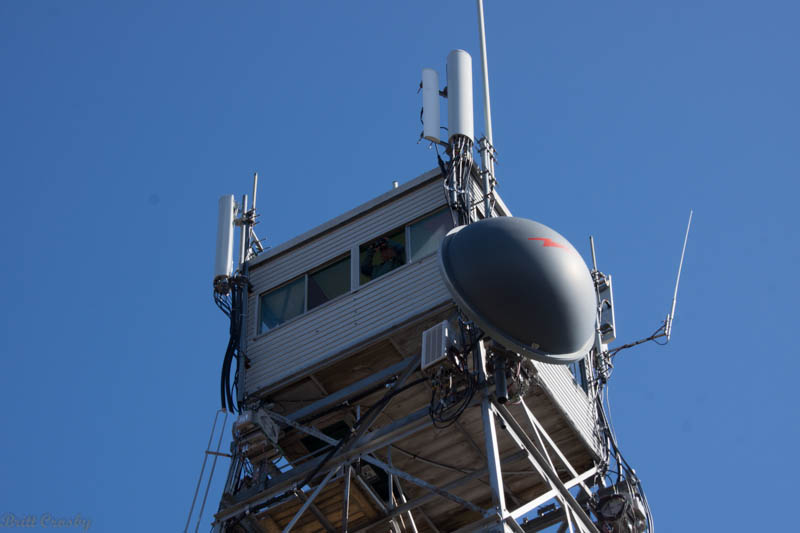
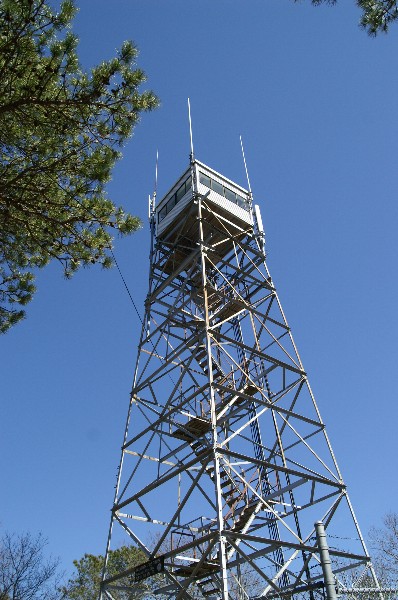
| BARNSTABLE FIRE TOWER |
The Barnstable Fire Tower as seen
from Route 6 in 1992. Note that the trees have grown considerably in
height in the four decades since the tower was built. Also of note
is that because of the convenient height and location of these
towers, they have also become useful for mounting radio and cell
phone antennas in recent years.
|
| MASSACHUSETTS FIRE
TOWERS |
This 1913 map shows where fire
towers were located in Massachusetts in that day. By the looks of
the circles, only one was on Cape Cod and only a couple in the
Plymouth / Bristol County area.
|
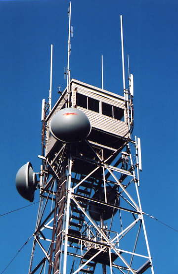
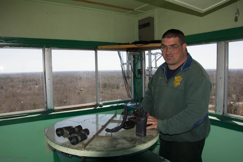
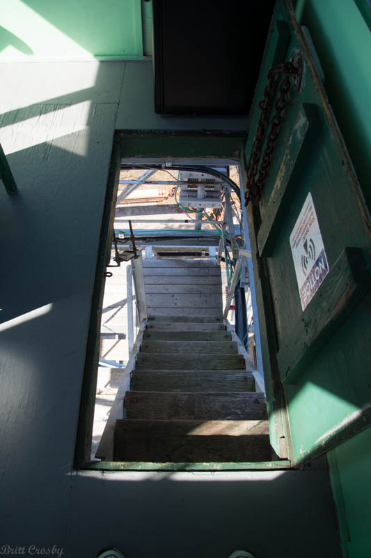
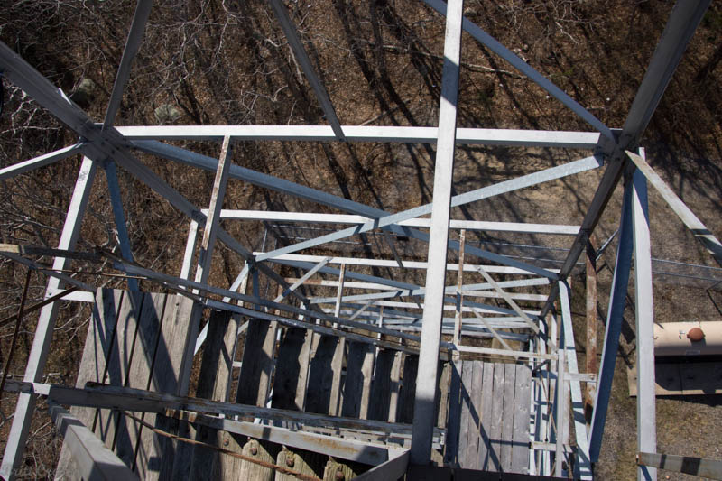
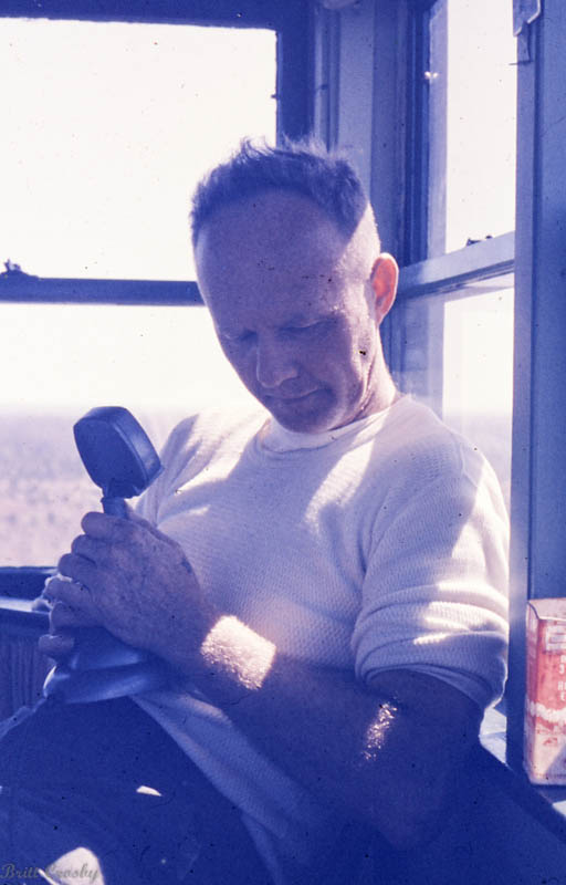
| INSIDE THE FIRE TOWER |
| The inside of the fire tower is
very simple and not built for comfort. The observation area has
windows all around. Some of the windows also open allowing for
ventilation and a better look with the glasses when needed.
A floor hatch is along one side
and is kept closed until it is time for the observer to come in or
out. In the center is a table with an area map under a piece of
glass. A device called an "alidade" is mounted in the center of the
table. It is able to pivot around as needed from its center mount.
On each end of the alidade are simple sights that the spotter uses
to line up by eye any smoke in the distance. A compass rose on the
map is then used to provide a directional compass bearing known as
the azimuth in degrees and fractions from the tower.
The bearing, or line, on the smoke is
then plotted on a topographical map that is folded down from the
ceiling on a piece of plywood. It shows the compass rose of the area
towers. Once two or more towers spot the smoke and line it up, the
base can be pinpointed and the appropriate agency can be sent to the
area.
The tower also has a fire radio, and
perhaps a chair or stool to sit on. Long days may have been improved
by listening in on the radio to a ball game or by reading. Perhaps a
lunch pale and a snack came with the observer. Depending on where
the tower was located, the observer may have been able to talk with
passersby or watch deer and other wildlife. Severe weather
conditions would send observers to the safety of their vehicle on
the ground.
|
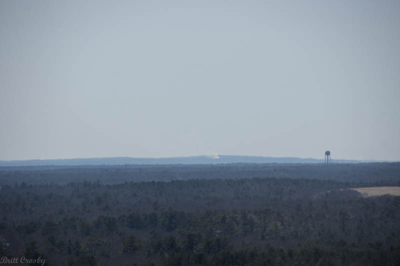
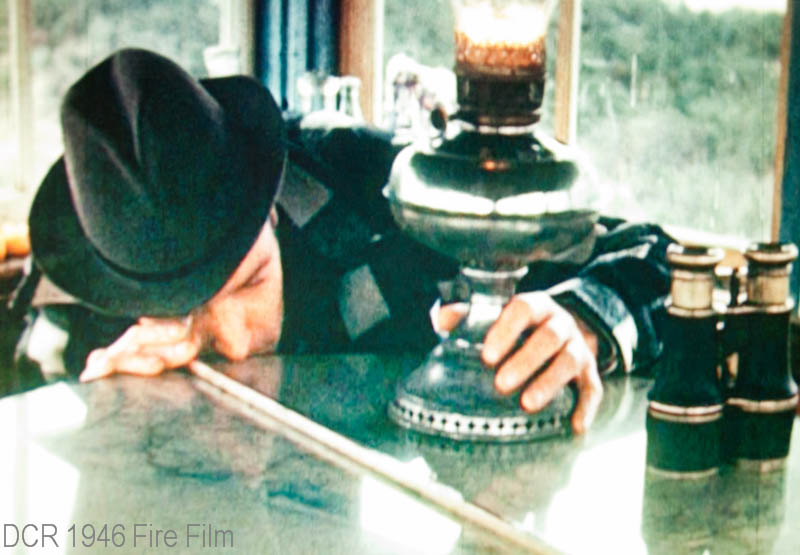
| SMOKE IN THE DISTANCE
|
The tower observer might see a
smoke in the distance.
|
| OBSERVATION |
After a few minutes of
observation, often with binoculars, the operator would determine if
the smoke is of concern or not.
|
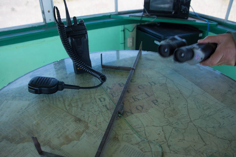
| ALIDADE |
The alidade is used to determine
a line which can then be communicated via radio to other towers or
fire stations who would cross up the lines to determine a general
location to respond to.
|
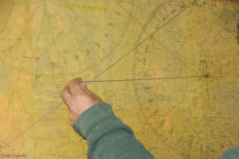
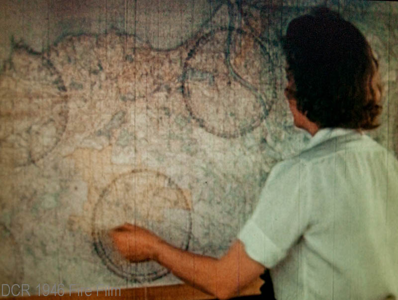
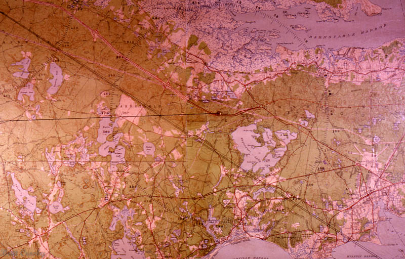
| TOPOGRAPHICAL MAP
|
The topographical map shows the
main features of the land including bodies of water, clearings,
elevations, roads, town lines, the compass roses' of the area towers
and other features that may help determine where to send equipment.
The two lines that intersect were then radioed to the local fire
department who could duplicate the crossing of the lines for their
own use.
|

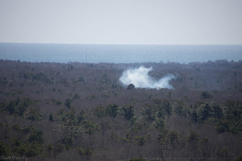
| PERMIT FIRE |
Not all smoke is of concern.
During the time of year when open burning is permitted, it is not
uncommon to have dozens or more smokes coming up within view. As
long as they behave themselves there is no reason to worry about
them. Sometimes, such as when a pile of leaves or perhaps a material
other than sticks is added to a permit fire it may briefly look
dramatic and get a little closer look to see if it returns to
normal.
|
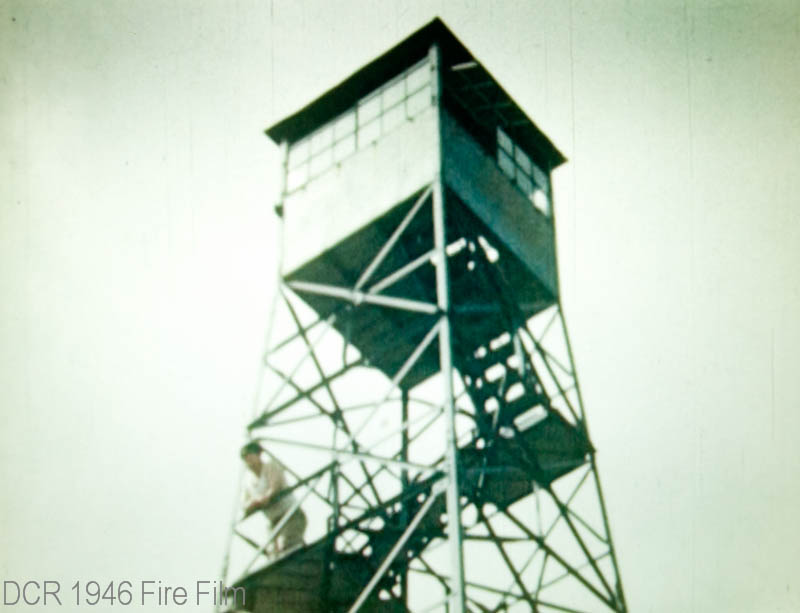
| BARNSTABLE FIRE TOWER IN
1946 |
| A major forest fire swept the
upper Cape over four days in April 1946. A film documenting the fire
included how the fire towers operated in those days. These clips
came from that film and show the tower, the operator's use of the
alidade, the plotting of lines on the topographical map, and how the
lines were plotted in the fire stations and other towers. |
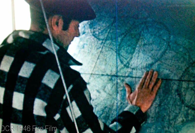
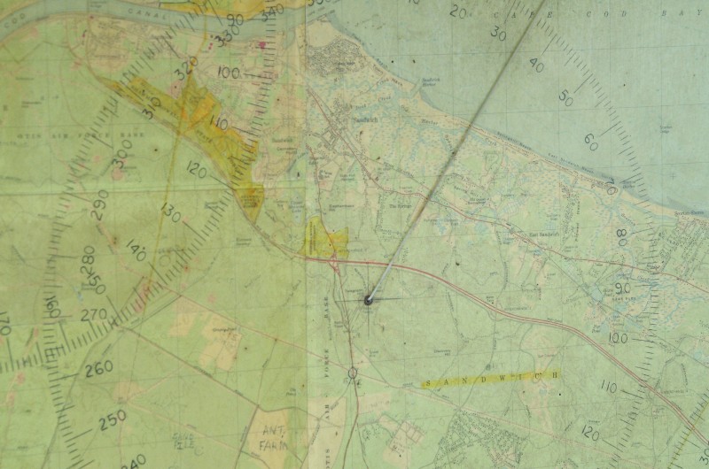
| BARNSTABLE TOWER |
| The line coming out of the center
of the map represents the Barnstable Fire Tower line going west
while another line from the Sandwich Tower comes in from the upper
left of the map. Where the lines cross, slightly to the right
(east) of a clearing (Cape Cod Airport Marstons Mills) put the smoke
in the area of Osterville-West Barnstable Road in Marstons Mills
north of Race lane and south of Route 6. That would be close enough
to send someone to find it on the ground. |
| FALMOUTH FIRE TOWER |
| A fire tower was built in 1914 on
Howlands Park Hill in West Falmouth. It is at about 192' above sea
level. Two way radio was also added in 1937. The original fire
tower was replaced in 1946 by the former Martha's Vineyard tower
which was re-erected in Falmouth. |
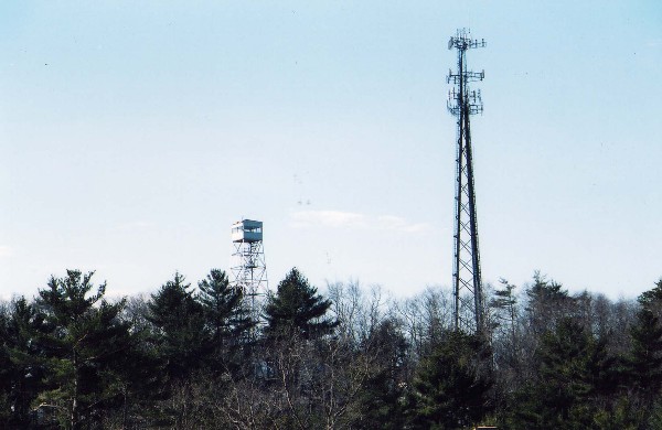
| BOURNE FIRE TOWER |
A newer photo
of the Bourne Fire Tower. This tower is located on Signal Hill,
overlooking the Cape Cod Canal and north into Myles Standish and
Plymouth. It was built in 1914 at 221' elevation. The original tower
built in 1914 was replaced in 1947 and then upgraded again in 1968.
Today the tower is dwarfed by the cell tower near by. For many years
the Bourne tower was the control tower for the district.
|
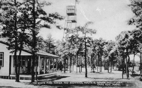
| WELLFLEET FIRE TOWER |
The original Wellfleet fire tower
was built in 1927. The towns in the lower Cape all pitched in to pay
for the tower which was placed at Brownies Campground along Route 6
in South Wellfleet. It is only 50 feet above sea level and the 68
foot steel tower was rebuilt in 1960 to replace the original
structure.
|
| SANDWICH FIRE TOWER |
| The Sandwich Fire Tower overlooks
the area where most of the historic Cape Cod forest fires have taken
place. It sit on Telegraph Hill, off of Route 130 south of Route 6
at 292 feet elevation. It was built in 1934. Radios were added in
1956. The tower offers the best view into the Massachusetts Military
Reservation, Camp Edwards where fires often started. It has become
the control tower for the district and may at times be the only
staffed tower, It has been used for cell towers as well. |

| DENNIS FIRE TOWER |
| The Dennis Fire Tower was built
in 1948 on Signal Hill off Holcum Rock Road on the north side.
Elevation 150 feet. |
| BREWSTER FIRE TOWER |
The Brewster Fire Tower is
located within the Nickerson State Park. It was added in 1949.
|

|
|
11 |
|
<PREV
TOP NEXT> |
11 -
SPOTTING FIRES - FIRE PATROL PLANES
|
|
Barnstable County Fire Patrol Plane P-18 |
Barnstable County and Plymouth County both operated Fire Patrol
Planes for many years. Going back to at least 1954, and perhaps
before, these planes could provide assistance in locating fires and
advising chiefs and personnel on the ground how to safely access
them. |
| |
|
12 |
|
<PREV
TOP NEXT> |
12 -
LOCATING FIRES - FIRE PATROL TRUCKS
|
|
Fire Patrol Trucks were also a vital aspect of battling wild fires. |
Before many fire departments were staffed, there were staffed Fire
Patrol trucks that would be in contact via radio with fire towers
and the fire patrol plane and often reached fires first. Shown here
around 1958 at the Marstons Mills Airport are the Town of Barnstable
Patrol truck 210 and the State Patrol Truck Car 3, as well as some
chiefs. |
| |
|
13 |
|
<PREV
TOP NEXT> |
13 - EARLY
FIREFIGHTING - BY HAND
|
|
In the beginning, fires were fought by hand |
Many of the largest fires were fought before there were many
motorvehicles |
| |
|
14 |
|
<PREV
TOP NEXT> |
14 - EARLY
FIRE APPARATUS
|
|
Photo |
| Info |
| |
|
15 |
|
<PREV
TOP NEXT> |
15 - FIRST
BRUSH BREAKERS
|
|
Photo |
| Info |
| |
|
16 |
|
<PREV
TOP NEXT> |
16 -
BARNSTABLE COUNTY BRUSH BREAKERS
|
|
Photo |
| Info |
| |
|
17 |
|
<PREV
TOP NEXT> |
17 - STATE -
FOREST FIRE TRUCKS
|
|
Photo |
| Info |
| |
|
18 |
|
<PREV
TOP NEXT> |
18 - ON THE
ISLANDS - BRUSH TRUCKS
|
|
Photo |
| Info |
| |
|
19 |
|
<PREV
TOP NEXT> |
19 -
PLYMOUTH COUNTY - BRUSH BREAKERS
|
|
Photo |
| Info |
| |
|
20 |
|
<PREV
TOP NEXT> |
20 - BRUSH
BREAKERS WORKING
|
|
Photo |
| Info |
| |
|
21 |
|
<PREV
TOP NEXT> |
21 - THE HEY
DAYS OF CAPE COD BRUSH BREAKERS
|
|
Photo |
| Info |
| |
|
22 |
|
<PREV
TOP NEXT> |
22 - TANKERS
AND OTHER SUPPORT UNITS
|
|
Photo |
| Info |
| |
|
23 |
|
<PREV
TOP NEXT> |
23 - FOREST
FIRE TRAINING
|
|
Photo |
| Info |
| |
|
24 |
|
<PREV
TOP NEXT> |
24 - SMALL,
MEDIUM, AND LARGE BRUSH TRUCKS
|
|
Photo |
| Info |
| |
|
25 |
|
<PREV
TOP NEXT> |
25 - SOME OF
THE NEWEST BRUSH BREAKERS
|
|
Photo |
| Info |
| |
|
26 |
|
<PREV
TOP NEXT> |
26 - THE END
TIMES
|
|
Photo |
| Info |
| |
| |
| |
| |
| |
|
|
|
<PREV
TOP NEXT> |
| |
